Fire Monitoring
We make the task plan of domestic satellite combined imaging and employ transit satellites to conduct consistent observation of the fire area, real-time monitoring of dynamic development of fire, quantitative analysis of fire perimeters and qualitative assessment of the fire situation, so as to provide information support for fire fighting.

Dynamic Time Change of Fire in Gaoming District, Foshan City Photographed by Gaofen-4 Satellite
We take advantage of geographical information, deep learning and other technologies to make analysis of remote sensing images to accurately identify the range of impact after the disaster and fire intensity, and to comprehensively assess the damage of the disaster in combination with the social and economical situation of the disaster area, with the automatic generation of thematic map data and fire monitoring and analysis report.

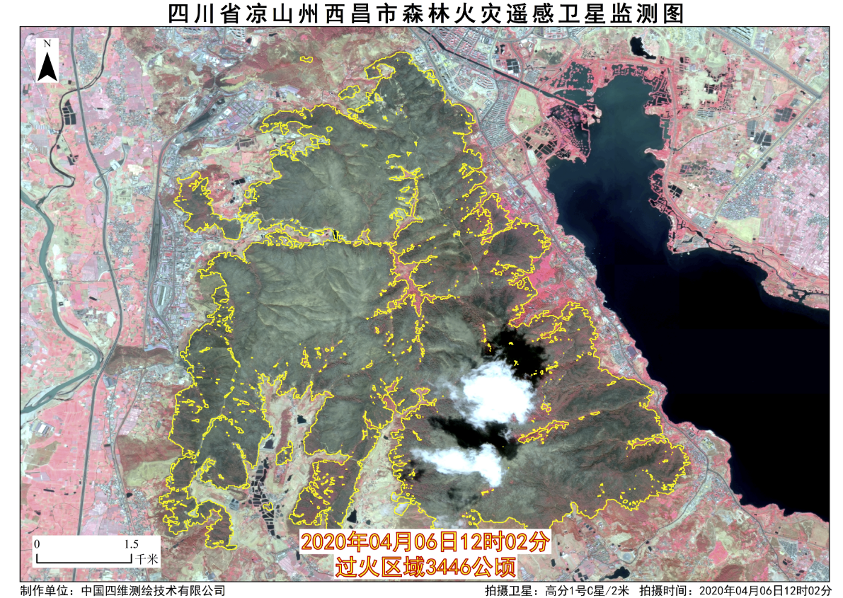
Remote Sensing Satellite Map of the Forest Fire in Xichang City, Liangshan Prefecture, Sichuan Province
Advantage and Features
Automatic Monitoring - Multi-frequency fire point information monitoring on a daily basis, with satellite imaging as frequent as every 5 seconds at least.
Precise Identification – Precise identification of fire point information, with identification precision higher than 97%.
Warning Broadcast – Automatic identification of fire point, automatic disaster information push, automatic alarm.


