Agriculture
We construct full-process application scenario of digital village including land resources monitoring, agricultural census, crop monitoring as well as agricultural credit and other products, and build closed-loop monitoring system covering the process of farming, planting, management and harvesting in agricultural production and life to ensure national food security, so as to provide strong support for digital rural construction and rural revitalization and development.
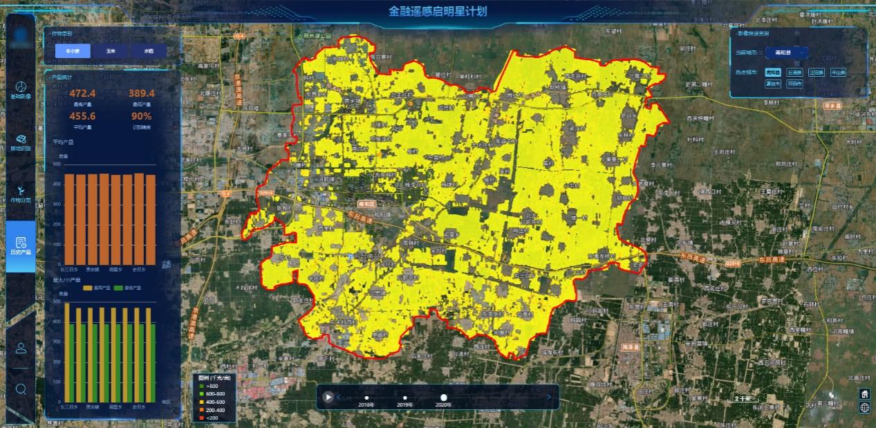
Visual Analysis System for Agricultural Monitoring
Farming – Acquiring Correct Statistics by Precise Monitoring for Arable Land Protection
China Siwei makes full use of the unique advantage of satellite remote sensing in large spatial scales monitoring, takes massive accurate data as the basis and utilizes the self-developed arable land extraction technology to carry out precise analysis of the types of land used in the area and to build digital base for arable land resources, with the purpose of providing digitalized and visualized support for subsequent scientific decision-making.
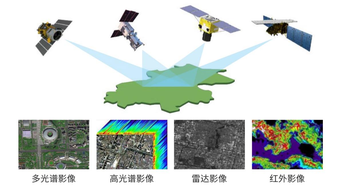
Remote Sensing Satellite Service Capabilities
Aiming at better monitoring and ensuring the grain sown area, we have developed the time series classification technology of multi-source remote sensing image, which can utilize Siwei World System to conduct automatic comparison of time series images on specific land lot, and combine crop “spectrum-time” curve to realize batch and multi-scale measurement of spatial distribution of crop cultivation, resulting in the great improvement of measurement efficiency and effective reduction of measurement cost.
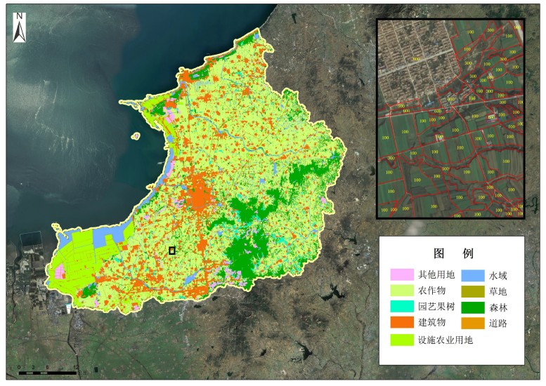
Distribution of Classification of Land Cover in Laizhou City, Shandong Province
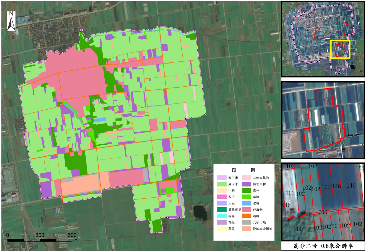
Distribution Map of Crop Cultivation Space in Qianguozhuang Village, Laicheng District, Laiwu City, Shandong Province
Management – Full-Process Management and Protection with Satellite Monitoring to Ensure Production
We apply reconstruction method of vegetation biomass index and remote
sensing reflectance data in comparison with multi-parameter comprehensive
evaluation model of crop growth to achieve in comprehensive evaluation and
grading of crop growth, which acts as the basis for the construction of the
yield estimation model to realize crop yield prediction.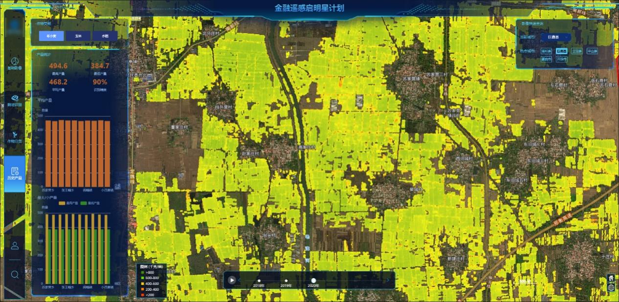
Analysis Chart of Winter Wheat Yield Evaluation in Julu County, Xingtai City, Hebei Province
Harvesting – Finance Helping Stabilizing Earnings as for the Support of Harvesting
We utilize financial remote sensing data middle office and take deep
learning model as the basis to automatically generate information products such
as arable land extraction, crop classification, yield analysis, disaster
assessment, which is applied in the business scenarios of agricultural credit
including access to credit, credit approval, credit life cycle monitoring, so as
to protect the interests of all parties in an all-round way.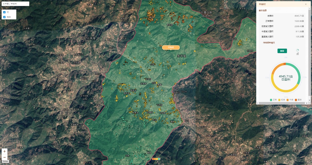
Schematic Diagram of Disaster Analysis of Agricultural Insurance Module


